
Thank you for supporting this site ❤️
Make a donation
Make a donation
Gear up for your next adventure:
As an Amazon Associate, this site earns from qualifying purchases at no extra cost to you.
Lauder topographic map
Click on the map to display elevation.
Thank you for supporting this site ❤️
Make a donation
Make a donation
Gear up for your next adventure:
As an Amazon Associate, this site earns from qualifying purchases at no extra cost to you.
About this map
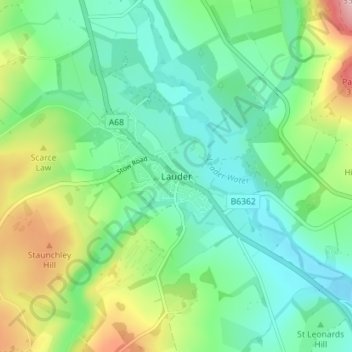
Name: Lauder topographic map, elevation, terrain.
Location: Lauder, Scottish Borders, Scotland, TD2 6SR, United Kingdom (55.69936 -2.76838 55.73936 -2.72838)
Average elevation: 679 ft
Minimum elevation: 482 ft
Maximum elevation: 1,155 ft
Thank you for supporting this site ❤️
Make a donation
Make a donation
Gear up for your next adventure:
As an Amazon Associate, this site earns from qualifying purchases at no extra cost to you.