
Dorohe topographic map
Interactive map
Click on the map to display elevation.
About this map
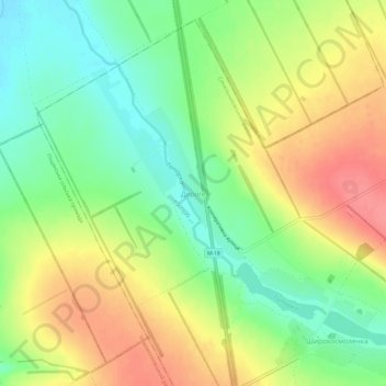
Name: Dorohe topographic map, elevation, terrain.
Average elevation: 312 ft
Minimum elevation: 194 ft
Maximum elevation: 449 ft
Other topographic maps
Click on a map to view its topography, its elevation and its terrain.
Dorohe
Ukraine > Dnipropetrovsk Oblast > Dorohe
Dorohe, Іларіонівська селищна громада, Synelnykove Raion, Dnipropetrovsk Oblast, 52551, Ukraine
Average elevation: 295 ft