
Pend Oreille Mine Tailings Pond Dam topographic map
Interactive map
Click on the map to display elevation.
About this map
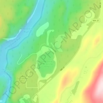
Name: Pend Oreille Mine Tailings Pond Dam topographic map, elevation, terrain.
Average elevation: 2,431 ft
Minimum elevation: 1,959 ft
Maximum elevation: 3,176 ft
Other topographic maps
Click on a map to view its topography, its elevation and its terrain.
Pend Orielle River
United States > Washington > Pend Oreille County
Pend Orielle River, Pend Oreille County, Washington, 83822, United States
Average elevation: 3,478 ft
Metaline
United States > Washington > Pend Oreille County
Metaline, Pend Oreille County, Washington, 99152, United States
Average elevation: 2,339 ft
Deer Valley
United States > Washington > Pend Oreille County > Deer Valley
Deer Valley, Pend Oreille County, Washington, United States
Average elevation: 2,375 ft
Kalispel Reservation
United States > Washington > Pend Oreille County > Airway Heights
Kalispel Reservation, Airway Heights, Pend Oreille County, Washington, United States
Average elevation: 2,628 ft
Metaline Falls
United States > Washington > Pend Oreille County
Metaline Falls, Pend Oreille County, Washington, 99153, United States
Average elevation: 2,362 ft
Mill Creek Point
United States > Washington > Pend Oreille County
Mill Creek Point, Pend Oreille County, Washington, United States
Average elevation: 4,183 ft