
Glen Saint Mary topographic map
Interactive map
Click on the map to display elevation.
About this map
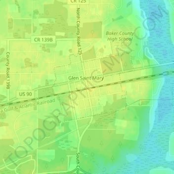
Name: Glen Saint Mary topographic map, elevation, terrain.
Location: Glen Saint Mary, Baker County, Florida, United States (30.26979 -82.16704 30.28067 -82.15090)
Average elevation: 121 ft
Minimum elevation: 82 ft
Maximum elevation: 141 ft
Other topographic maps
Click on a map to view its topography, its elevation and its terrain.
Macclenny
United States > Florida > Baker County
Macclenny, Baker County, Florida, 32063, United States
Average elevation: 128 ft
Osceola National Forest
United States > Florida > Baker County
Osceola National Forest, Baker County, Florida, United States
Average elevation: 121 ft
Macclenny
United States > Florida > Baker County > Macclenny > Macclenny
Macclenny, Baker County, Florida, 32063, United States
Average elevation: 131 ft