
Gravel Hill topographic map
Interactive map
Click on the map to display elevation.
About this map
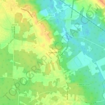
Name: Gravel Hill topographic map, elevation, terrain.
Average elevation: 115 ft
Minimum elevation: 56 ft
Maximum elevation: 184 ft
Other topographic maps
Click on a map to view its topography, its elevation and its terrain.
Half Acre
United States > New Jersey > Middlesex County > Monroe Township
Half Acre, Monroe Township, Middlesex County, New Jersey, 08831, United States
Average elevation: 138 ft
Clearbrook
United States > New Jersey > Middlesex County > Monroe Township
Clearbrook, Monroe Township, Middlesex County, New Jersey, 08813, United States
Average elevation: 128 ft