
Thank you for supporting this site ❤️
Make a donation
Make a donation
Gear up for your next adventure:
As an Amazon Associate, this site earns from qualifying purchases at no extra cost to you.
Merced topographic map
Click on the map to display elevation.
Thank you for supporting this site ❤️
Make a donation
Make a donation
Gear up for your next adventure:
As an Amazon Associate, this site earns from qualifying purchases at no extra cost to you.
About this map
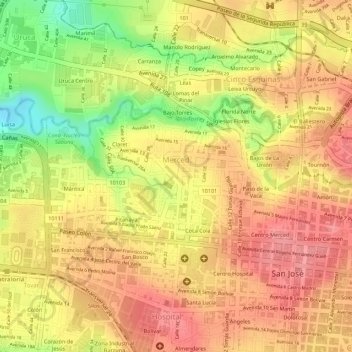
Name: Merced topographic map, elevation, terrain.
Location: Merced, Cantón San José, San Jose Province, 10102, Costa Rica (9.93404 -84.09836 9.94588 -84.07836)
Average elevation: 3,743 ft
Minimum elevation: 3,540 ft
Maximum elevation: 3,845 ft
Thank you for supporting this site ❤️
Make a donation
Make a donation
Gear up for your next adventure:
As an Amazon Associate, this site earns from qualifying purchases at no extra cost to you.