
Thank you for supporting this site ❤️
Make a donation
Make a donation
Gear up for your next adventure:
As an Amazon Associate, this site earns from qualifying purchases at no extra cost to you.
Hede topographic map
Click on the map to display elevation.
Thank you for supporting this site ❤️
Make a donation
Make a donation
Gear up for your next adventure:
As an Amazon Associate, this site earns from qualifying purchases at no extra cost to you.
About this map
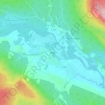
Name: Hede topographic map, elevation, terrain.
Location: Hede, Härjedalens kommun, Jämtland County, Sweden (62.39934 13.49668 62.43934 13.53668)
Average elevation: 1,463 ft
Minimum elevation: 1,312 ft
Maximum elevation: 2,031 ft
Thank you for supporting this site ❤️
Make a donation
Make a donation
Gear up for your next adventure:
As an Amazon Associate, this site earns from qualifying purchases at no extra cost to you.