
Saint John topographic map
Interactive map
Click on the map to display elevation.
About this map
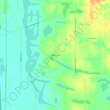
Name: Saint John topographic map, elevation, terrain.
Location: Saint John, Warrick County, Indiana, United States (38.05921 -87.47001 38.09921 -87.43001)
Average elevation: 407 ft
Minimum elevation: 361 ft
Maximum elevation: 486 ft
Other topographic maps
Click on a map to view its topography, its elevation and its terrain.
Chandler
United States > Indiana > Warrick County
Chandler, Warrick County, Indiana, 47610, United States
Average elevation: 423 ft
Boonville
United States > Indiana > Warrick County
Boonville, Warrick County, Indiana, 47601, United States
Average elevation: 427 ft
Newburgh
United States > Indiana > Warrick County > Newburgh
Newburgh, Warrick County, Indiana, 47630-1234, United States
Average elevation: 394 ft
Newburgh
United States > Indiana > Warrick County
Newburgh, Warrick County, Indiana, United States
Average elevation: 404 ft