
Deer Lake Park topographic map
Interactive map
Click on the map to display elevation.
About this map
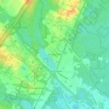
Name: Deer Lake Park topographic map, elevation, terrain.
Average elevation: 43 ft
Minimum elevation: 0 ft
Maximum elevation: 108 ft
Other topographic maps
Click on a map to view its topography, its elevation and its terrain.
Ocean Acres
United States > New Jersey > Ocean County > Stafford Township
Ocean Acres, Stafford Township, Ocean County, New Jersey, United States
Average elevation: 89 ft