
Thank you for supporting this site ❤️
Make a donation
Make a donation
Gear up for your next adventure:
As an Amazon Associate, this site earns from qualifying purchases at no extra cost to you.
Prodromos topographic map
Click on the map to display elevation.
Thank you for supporting this site ❤️
Make a donation
Make a donation
Gear up for your next adventure:
As an Amazon Associate, this site earns from qualifying purchases at no extra cost to you.
About this map
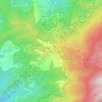
Name: Prodromos topographic map, elevation, terrain.
Location: Prodromos, Limassol District, Cyprus, 2850, Cyprus (34.92995 32.81249 34.96995 32.85249)
Average elevation: 4,301 ft
Minimum elevation: 2,848 ft
Maximum elevation: 6,266 ft
Thank you for supporting this site ❤️
Make a donation
Make a donation
Gear up for your next adventure:
As an Amazon Associate, this site earns from qualifying purchases at no extra cost to you.