
East Vincent Township topographic map
Interactive map
Click on the map to display elevation.
About this map
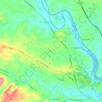
Name: East Vincent Township topographic map, elevation, terrain.
Average elevation: 240 ft
Minimum elevation: 85 ft
Maximum elevation: 656 ft
Other topographic maps
Click on a map to view its topography, its elevation and its terrain.
Hiestand
United States > Pennsylvania > Chester County > East Vincent Township
Hiestand, East Vincent Township, Chester County, Pennsylvania, 19475, United States
Average elevation: 292 ft
Slonaker
United States > Pennsylvania > Chester County > East Vincent Township > Slonaker
Slonaker, East Vincent Township, Chester County, Pennsylvania, 19421, United States
Average elevation: 322 ft