
Thank you for supporting this site ❤️
Make a donation
Make a donation
Gear up for your next adventure:
As an Amazon Associate, this site earns from qualifying purchases at no extra cost to you.
盘克镇 topographic map
Click on the map to display elevation.
Thank you for supporting this site ❤️
Make a donation
Make a donation
Gear up for your next adventure:
As an Amazon Associate, this site earns from qualifying purchases at no extra cost to you.
About this map
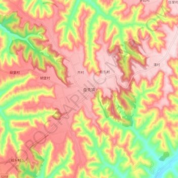
Name: 盘克镇 topographic map, elevation, terrain.
Location: 盘克镇, 宁县, 庆阳市, 甘肃省, 中国 (35.70858 108.20392 35.78858 108.28392)
Average elevation: 4,439 ft
Minimum elevation: 3,760 ft
Maximum elevation: 4,879 ft
Thank you for supporting this site ❤️
Make a donation
Make a donation
Gear up for your next adventure:
As an Amazon Associate, this site earns from qualifying purchases at no extra cost to you.