Geolocate

Chain O'Lakes State Park topographic map

Click on the map to display elevation.

About this map

Name: Chain O'Lakes State Park topographic map, elevation, terrain.

Location: Chain O'Lakes State Park, Fox Lake, Lake County, Illinois, United States (42.43784 -88.21204 42.47938 -88.16611)

Average elevation: 781 ft

Minimum elevation: 728 ft

Maximum elevation: 889 ft

Other topographic maps

Click on a map to view its topography, its elevation and its terrain.
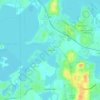
Kings Island

United States > Illinois > Lake County > Fox Lake

Average elevation: 751 ft

Gear up for your next adventure:

🏕️Family Camping Gear - Essentials for group camping trips
🧥Men's Rain Shells - Premium waterproof and breathable jackets for mountain weather
📷Action Cameras - Rugged cameras to document your journeys across rugged terrain
🩳Quick‑Dry Hiking Shorts - Comfortable and quick‑dry shorts for summer hiking
🪶Paracord Bracelet - Survival bracelet with built‑in tools

As an Amazon Associate, this site earns from qualifying purchases at no extra cost to you.