
Thank you for supporting this site ❤️
Make a donation
Make a donation
Gear up for your next adventure:
As an Amazon Associate, this site earns from qualifying purchases at no extra cost to you.
红石林镇 topographic map
Click on the map to display elevation.
Thank you for supporting this site ❤️
Make a donation
Make a donation
Gear up for your next adventure:
As an Amazon Associate, this site earns from qualifying purchases at no extra cost to you.
About this map
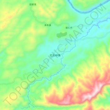
Name: 红石林镇 topographic map, elevation, terrain.
Location: 红石林镇, 古丈县, 湘西土家族苗族自治州, 湖南省, 中国 (28.67046 109.83692 28.75046 109.91692)
Average elevation: 1,467 ft
Minimum elevation: 636 ft
Maximum elevation: 3,143 ft
Thank you for supporting this site ❤️
Make a donation
Make a donation
Gear up for your next adventure:
As an Amazon Associate, this site earns from qualifying purchases at no extra cost to you.