
Livno topographic map
Interactive map
Click on the map to display elevation.
About this map
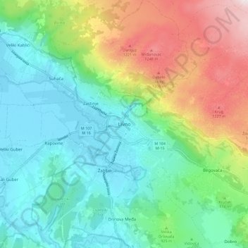
Name: Livno topographic map, elevation, terrain.
Average elevation: 2,976 ft
Minimum elevation: 2,323 ft
Maximum elevation: 4,462 ft
Other topographic maps
Click on a map to view its topography, its elevation and its terrain.
Dinaric Alps
Bosnia and Herzegovina > Federation of Bosnia and Herzegovina > City of Livno
Dinaric Alps, City of Livno, Herzeg-Bosnia Canton, Federation of Bosnia and Herzegovina, Bosnia and Herzegovina
Average elevation: 5,246 ft