
Ora District topographic map
Interactive map
Click on the map to display elevation.
About this map
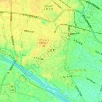
Name: Ora District topographic map, elevation, terrain.
Location: Oizumi, Ora District, Gunma Prefecture, Kanto, Japan (36.21796 139.38244 36.27645 139.43698)
Average elevation: 105 ft
Minimum elevation: 62 ft
Maximum elevation: 138 ft
Other topographic maps
Click on a map to view its topography, its elevation and its terrain.
Osawa
Japan > Gunma Prefecture > Katashina
Osawa, Katashina, Tone District, Gunma Prefecture, Kanto, Japan
Average elevation: 3,635 ft
Agatsuma District
Agatsuma District, Gunma Prefecture, Kanto, Japan
Average elevation: 3,415 ft