
Biskra topographic map
Interactive map
Click on the map to display elevation.
About this map
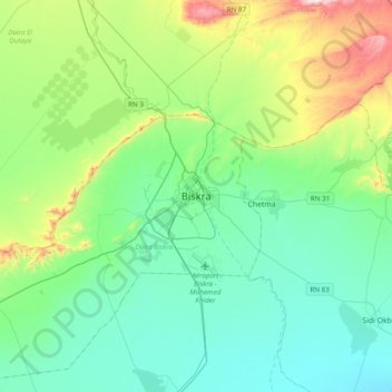
Name: Biskra topographic map, elevation, terrain.
Location: Biskra, Biskra District, Biskra, 0700, Algeria (34.69085 5.56869 35.01085 5.88869)
Average elevation: 551 ft
Minimum elevation: 52 ft
Maximum elevation: 2,257 ft
Other topographic maps
Click on a map to view its topography, its elevation and its terrain.