
Hato topographic map
Interactive map
Click on the map to display elevation.
About this map
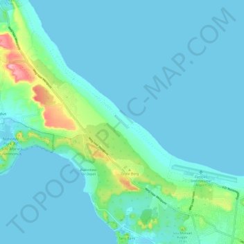
Name: Hato topographic map, elevation, terrain.
Location: Hato, Curacao, Netherlands (12.17610 -69.03934 12.24929 -68.92019)
Average elevation: 66 ft
Minimum elevation: 0 ft
Maximum elevation: 486 ft