
Sidi Thabet topographic map
Interactive map
Click on the map to display elevation.
About this map
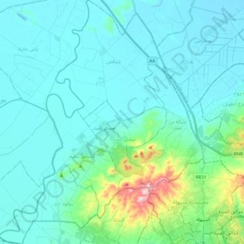
Name: Sidi Thabet topographic map, elevation, terrain.
Location: Sidi Thabet, Ariana, Tunisie (36.83836 9.96329 36.98493 10.11728)
Average elevation: 148 ft
Minimum elevation: 0 ft
Maximum elevation: 1,063 ft
Other topographic maps
Click on a map to view its topography, its elevation and its terrain.