
Bolívar topographic map
Interactive map
Click on the map to display elevation.
About this map
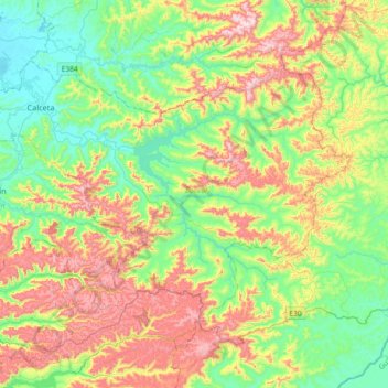
Name: Bolívar topographic map, elevation, terrain.
Location: Bolívar, Manabí, 130602, Ecuador (-1.04937 -80.23712 -0.80999 -79.87222)
Average elevation: 666 ft
Minimum elevation: 16 ft
Maximum elevation: 1,811 ft
Other topographic maps
Click on a map to view its topography, its elevation and its terrain.
El Achiote
Ecuador > Manabí > 24 de Mayo
El Achiote, Parroquia Bellavista, 24 de Mayo, Manabí, Ecuador
Average elevation: 430 ft