
Fuensaldaña topographic map
Interactive map
Click on the map to display elevation.
About this map
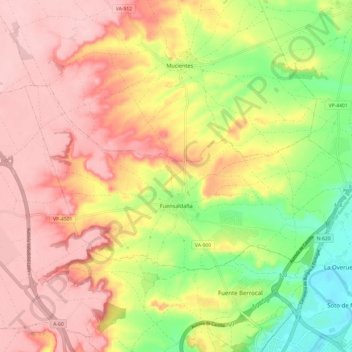
Name: Fuensaldaña topographic map, elevation, terrain.
Location: Fuensaldaña, Valladolid, Castile and León, 47194, Spain (41.69073 -4.81576 41.73748 -4.69503)
Average elevation: 2,559 ft
Minimum elevation: 2,241 ft
Maximum elevation: 2,795 ft