Monk's Cowl topographic map
Interactive map
Click on the map to display elevation.
About this map
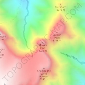
Name: Monk's Cowl topographic map, elevation, terrain.
Average elevation: 9,219 ft
Minimum elevation: 7,198 ft
Maximum elevation: 11,060 ft

Click on the map to display elevation.
Name: Monk's Cowl topographic map, elevation, terrain.
Average elevation: 9,219 ft
Minimum elevation: 7,198 ft
Maximum elevation: 11,060 ft