
Makalu topographic map
Interactive map
Click on the map to display elevation.
About this map
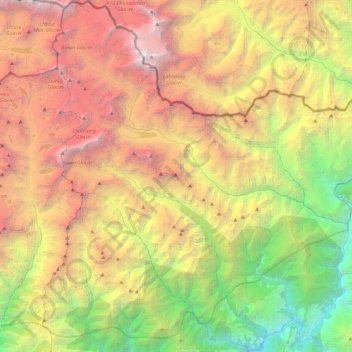
Name: Makalu topographic map, elevation, terrain.
Average elevation: 13,346 ft
Minimum elevation: 2,303 ft
Maximum elevation: 27,480 ft
Other topographic maps
Click on a map to view its topography, its elevation and its terrain.
Mahalangur Himal
Nepal > Eastern Development Region > Makalu
Mahalangur Himal, Makalu, Sankhuwasabha, Koshi, Eastern Development Region, Nepal
Average elevation: 15,404 ft