
Mount Lhotse topographic map
Interactive map
Click on the map to display elevation.
About this map
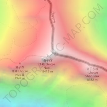
Name: Mount Lhotse topographic map, elevation, terrain.
Location: Mount Lhotse, Tingri County, Shigatse, Tibet, China (27.96159 86.93262 27.96169 86.93272)
Average elevation: 24,196 ft
Minimum elevation: 18,743 ft
Maximum elevation: 27,884 ft
Other topographic maps
Click on a map to view its topography, its elevation and its terrain.
Mount Everest
Nepal > Eastern Development Region > Khumjung
Mount Everest, Khumjung, Solukhumbu, Sagarmatha, Eastern Development Region, Nepal
Average elevation: 25,725 ft
Lhotse Shar
Nepal > Eastern Development Region > Khumjung
Lhotse Shar, Khumjung, Solukhumbu, Sagarmatha, Eastern Development Region, Nepal
Average elevation: 23,468 ft