
Paso Ancho topographic map
Interactive map
Click on the map to display elevation.
About this map
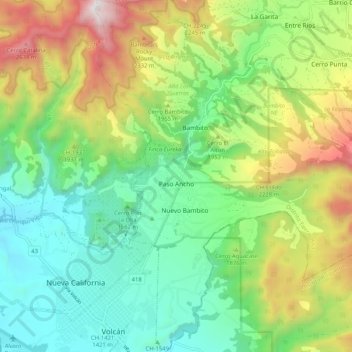
Name: Paso Ancho topographic map, elevation, terrain.
Location: Paso Ancho, Distrito Tierras Altas, Chiriquí, Panamá (8.76758 -82.64232 8.86960 -82.54239)
Average elevation: 5,984 ft
Minimum elevation: 4,222 ft
Maximum elevation: 9,367 ft