
Bordeira topographic map
Interactive map
Click on the map to display elevation.
About this map
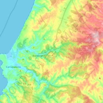
Name: Bordeira topographic map, elevation, terrain.
Location: Bordeira, AJZ, Faro, Algarve, Portugal (37.14947 -8.91822 37.25232 -8.77604)
Average elevation: 236 ft
Minimum elevation: -3 ft
Maximum elevation: 745 ft