
Isla de Cedros topographic map
Interactive map
Click on the map to display elevation.
About this map
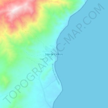
Name: Isla de Cedros topographic map, elevation, terrain.
Location: Isla de Cedros, Ensenada, Baja California, 22990, Mexico (28.05636 -115.22858 28.13636 -115.14858)
Average elevation: 633 ft
Minimum elevation: 0 ft
Maximum elevation: 3,891 ft