
Rio Urial topographic map
Interactive map
Click on the map to display elevation.
About this map
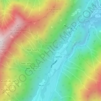
Name: Rio Urial topographic map, elevation, terrain.
Location: Rio Urial, Scopa, VC, Piemont, Italy (45.80595 8.11299 45.80971 8.12620)
Average elevation: 3,035 ft
Minimum elevation: 1,801 ft
Maximum elevation: 5,026 ft