
Montrose topographic map
Interactive map
Click on the map to display elevation.
About this map
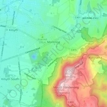
Name: Montrose topographic map, elevation, terrain.
Location: Montrose, Shire of Yarra Ranges, Victoria, 3765, Australia (-37.83486 145.32291 -37.78697 145.37469)
Average elevation: 784 ft
Minimum elevation: 217 ft
Maximum elevation: 2,037 ft
Other topographic maps
Click on a map to view its topography, its elevation and its terrain.
Dandenong Ranges National Park - Ferntree Gully
Australia > Victoria > Montrose
Dandenong Ranges National Park - Ferntree Gully, Bradley Track, Olinda, Montrose, Shire of Yarra Ranges, Victoria, 3765, Australia
Average elevation: 1,132 ft