
Khotsimsk District topographic map
Interactive map
Click on the map to display elevation.
About this map
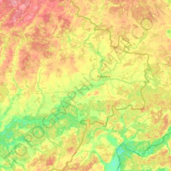
Name: Khotsimsk District topographic map, elevation, terrain.
Location: Khotsimsk District, Mahilyow Region, 213660, Belarus (53.18610 32.23321 53.58621 32.76278)
Average elevation: 558 ft
Minimum elevation: 446 ft
Maximum elevation: 699 ft
Other topographic maps
Click on a map to view its topography, its elevation and its terrain.
Алень
Belarus > Mahilyow Region > Mogilev District > Семукацкі сельскі Савет
Алень, Семукацкі сельскі Савет, Mogilev District, Mahilyow Region, Belarus
Average elevation: 545 ft
Horki
Belarus > Mahilyow Region > Horki
Horki, Horki District, Mahilyow Region, Belarus
Average elevation: 633 ft
Mogilev District
Mogilev District, Mahilyow Region, Belarus
Average elevation: 571 ft