
Airole topographic map
Interactive map
Click on the map to display elevation.
About this map
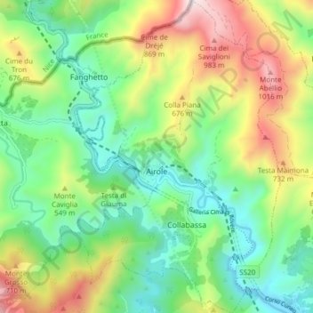
Name: Airole topographic map, elevation, terrain.
Location: Airole, IM, Liguria, Italy (43.84643 7.53487 43.90078 7.58395)
Average elevation: 1,335 ft
Minimum elevation: 144 ft
Maximum elevation: 3,530 ft