
Maxwelton topographic map
Interactive map
Click on the map to display elevation.
About this map
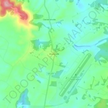
Name: Maxwelton topographic map, elevation, terrain.
Location: Maxwelton, Greenbrier County, West Virginia, 24957, USA (37.84623 -80.42980 37.88623 -80.38980)
Average elevation: 2,287 ft
Minimum elevation: 2,129 ft
Maximum elevation: 2,703 ft