
Carthage topographic map
Interactive map
Click on the map to display elevation.
About this map
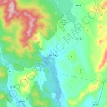
Name: Carthage topographic map, elevation, terrain.
Location: Carthage, Franklin County, Maine, USA (44.57924 -70.55049 44.67497 -70.32710)
Average elevation: 997 ft
Minimum elevation: 410 ft
Maximum elevation: 2,635 ft