
Tula de Allende topographic map
Interactive map
Click on the map to display elevation.
About this map
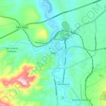
Name: Tula de Allende topographic map, elevation, terrain.
Location: Tula de Allende, Hidalgo, 42831, Mexico (20.01170 -99.38507 20.09170 -99.30507)
Average elevation: 6,890 ft
Minimum elevation: 6,627 ft
Maximum elevation: 7,749 ft