
Buttu Damma topographic map
Interactive map
Click on the map to display elevation.
About this map
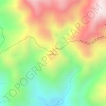
Name: Buttu Damma topographic map, elevation, terrain.
Location: Buttu Damma, Mamuju, West Sulawesi, Indonesia (-2.90545 119.20995 -2.90535 119.21005)
Average elevation: 4,406 ft
Minimum elevation: 3,202 ft
Maximum elevation: 5,617 ft
Other topographic maps
Click on a map to view its topography, its elevation and its terrain.
Tanete Gandangdewata
Indonesia > West Sulawesi > Mamuju
Tanete Gandangdewata, Mamuju, West Sulawesi, Indonesia
Average elevation: 9,075 ft