
Nyala topographic map
Interactive map
Click on the map to display elevation.
About this map
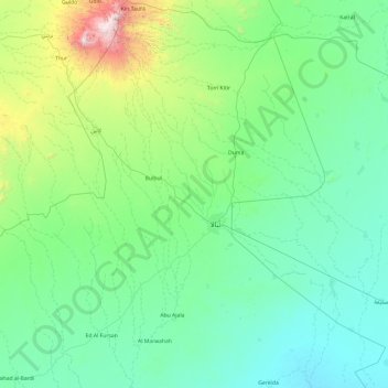
Name: Nyala topographic map, elevation, terrain.
Location: Nyala, South Darfur State, 099, Sudan (11.25368 24.32513 13.13302 25.72290)
Average elevation: 2,507 ft
Minimum elevation: 1,526 ft
Maximum elevation: 9,787 ft
Other topographic maps
Click on a map to view its topography, its elevation and its terrain.
El Fifi
Sudan > South Darfur State > Buram
El Fifi, Buram, South Darfur State, Sudan
Average elevation: 1,598 ft