
Vestmannaeyjabær topographic map
Interactive map
Click on the map to display elevation.
About this map
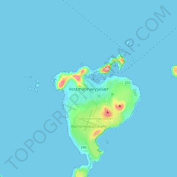
Name: Vestmannaeyjabær topographic map, elevation, terrain.
Location: Vestmannaeyjabær, Southern Region, Iceland (63.40010 -20.31859 63.48010 -20.23859)
Average elevation: 33 ft
Minimum elevation: -26 ft
Maximum elevation: 797 ft
Other topographic maps
Click on a map to view its topography, its elevation and its terrain.
Eldfell
Eldfell, Vestmannaeyjabær, Southern Region, 900, Iceland
Average elevation: 148 ft