
Grand Falls topographic map
Interactive map
Click on the map to display elevation.
About this map
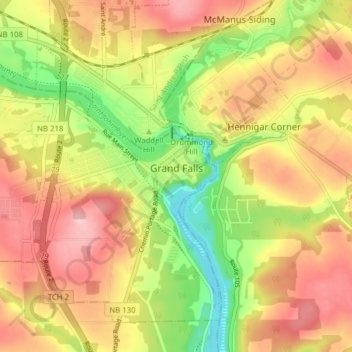
Name: Grand Falls topographic map, elevation, terrain.
Location: Grand Falls, Victoria County, New Brunswick, Canada (47.02299 -67.79020 47.06722 -67.71237)
Average elevation: 584 ft
Minimum elevation: 282 ft
Maximum elevation: 837 ft
Other topographic maps
Click on a map to view its topography, its elevation and its terrain.
Aroostook
Canada > New Brunswick > Victoria County > Aroostook
Aroostook, Andover Parish, Victoria County, New Brunswick, Canada
Average elevation: 466 ft
Fox Ridge
Canada > New Brunswick > Victoria County
Fox Ridge, Gordon Parish, Victoria County, New Brunswick, Canada
Average elevation: 1,677 ft