
Laugarvatn topographic map
Interactive map
Click on the map to display elevation.
About this map
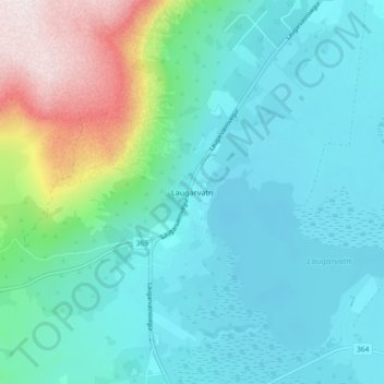
Name: Laugarvatn topographic map, elevation, terrain.
Location: Laugarvatn, Bláskógabyggð, Southern Region, 840, Iceland (64.19717 -20.75342 64.23717 -20.71342)
Average elevation: 561 ft
Minimum elevation: 180 ft
Maximum elevation: 2,021 ft