
Caldwell topographic map
Interactive map
Click on the map to display elevation.
About this map
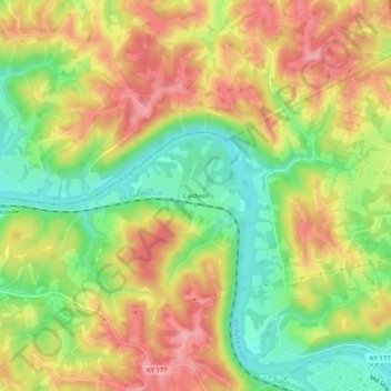
Name: Caldwell topographic map, elevation, terrain.
Location: Caldwell, Pendleton County, Kentucky, 41033, United States (38.78673 -84.41133 38.82673 -84.37133)
Average elevation: 682 ft
Minimum elevation: 463 ft
Maximum elevation: 892 ft
Other topographic maps
Click on a map to view its topography, its elevation and its terrain.
Catawba
United States > Kentucky > Pendleton County > Catawba
Catawba, Pendleton County, Kentucky, United States
Average elevation: 623 ft
Falmouth
United States > Kentucky > Pendleton County
Falmouth, Pendleton County, Kentucky, 41040, United States
Average elevation: 614 ft