
Synogać topographic map
Interactive map
Click on the map to display elevation.
About this map
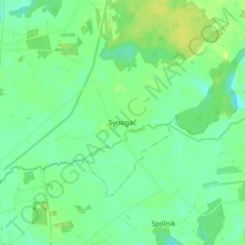
Name: Synogać topographic map, elevation, terrain.
Average elevation: 315 ft
Minimum elevation: 289 ft
Maximum elevation: 341 ft
Other topographic maps
Click on a map to view its topography, its elevation and its terrain.
Boguszyce
Poland > Greater Poland Voivodeship > Konin County
Boguszyce, gmina Wierzbinek, Konin County, Greater Poland Voivodeship, 62-618, Poland
Average elevation: 322 ft
Modła
Poland > Greater Poland Voivodeship > Konin County
Modła, gmina Rzgów, Konin County, Greater Poland Voivodeship, 62-586, Poland
Average elevation: 279 ft