
Nationaal Park De Hoge Veluwe topographic map
Interactive map
Click on the map to display elevation.
About this map
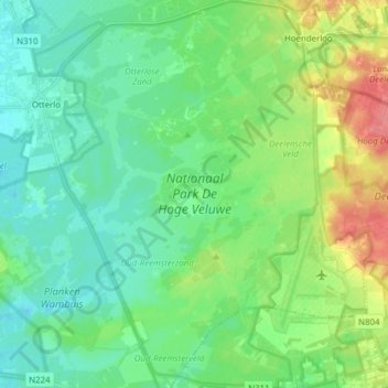
Name: Nationaal Park De Hoge Veluwe topographic map, elevation, terrain.
Average elevation: 135 ft
Minimum elevation: 72 ft
Maximum elevation: 285 ft
Other topographic maps
Click on a map to view its topography, its elevation and its terrain.
Oud-Reemst
Nederland > Gelderland > Otterlo > Oud-Reemst
Oud-Reemst, Otterlo, Ede, Gelderland, Nederland, 6731, Nederland
Average elevation: 118 ft