
Palomas topographic map
Interactive map
Click on the map to display elevation.
About this map
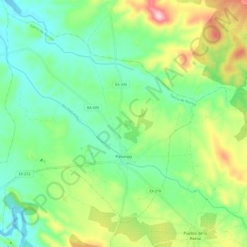
Name: Palomas topographic map, elevation, terrain.
Location: Palomas, Tierra de Barros, Badajoz, Extremadura, Spain (38.66483 -6.21581 38.74439 -6.10188)
Average elevation: 1,155 ft
Minimum elevation: 866 ft
Maximum elevation: 1,762 ft
Other topographic maps
Click on a map to view its topography, its elevation and its terrain.
Almendralejo
Spain > Extremadura > Tierra de Barros
Almendralejo, Tierra de Barros, Badajoz, Extremadura, 06200, Spain
Average elevation: 1,089 ft