
Gustavia topographic map
Interactive map
Click on the map to display elevation.
About this map
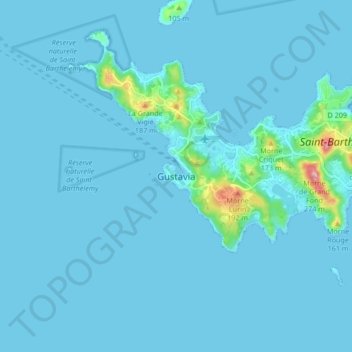
Name: Gustavia topographic map, elevation, terrain.
Location: Gustavia, Saint Barthélemy, 97133, France (17.85570 -62.89084 17.93570 -62.81084)
Average elevation: 46 ft
Minimum elevation: 0 ft
Maximum elevation: 817 ft