
Calantas topographic map
Interactive map
Click on the map to display elevation.
About this map
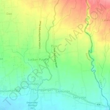
Name: Calantas topographic map, elevation, terrain.
Location: Calantas, Batangas, Calabarzon, 4213, Philippines (13.93813 120.73781 13.97813 120.77781)
Average elevation: 138 ft
Minimum elevation: 16 ft
Maximum elevation: 312 ft