
Castor topographic map
Interactive map
Click on the map to display elevation.
About this map
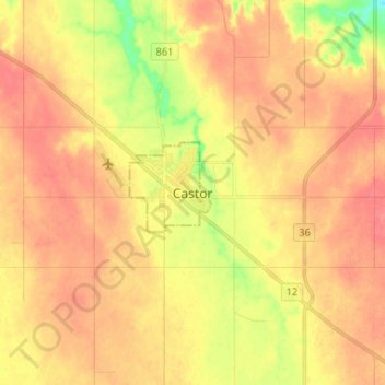
Name: Castor topographic map, elevation, terrain.
Location: Castor, Town of Castor, Alberta, T0C 0X0, Canada (52.17667 -111.94000 52.25667 -111.86000)
Average elevation: 2,694 ft
Minimum elevation: 2,575 ft
Maximum elevation: 2,756 ft