
Honey Harbour topographic map
Interactive map
Click on the map to display elevation.
About this map
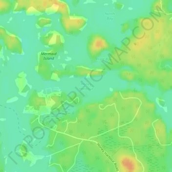
Name: Honey Harbour topographic map, elevation, terrain.
Average elevation: 600 ft
Minimum elevation: 554 ft
Maximum elevation: 659 ft
Other topographic maps
Click on a map to view its topography, its elevation and its terrain.
Stewart Lake
Canada > Ontario > Muskoka District > Georgian Bay Township > MacTier
Stewart Lake, MacTier, Georgian Bay Township, District Municipality of Muskoka, Muskoka District, Central Ontario, Ontario, Canada
Average elevation: 791 ft
MacTier
Canada > Ontario > Muskoka District > Georgian Bay Township
MacTier, Georgian Bay Township, District Municipality of Muskoka, Muskoka District, Central Ontario, Ontario, Canada
Average elevation: 791 ft