
Armería topographic map
Interactive map
Click on the map to display elevation.
About this map
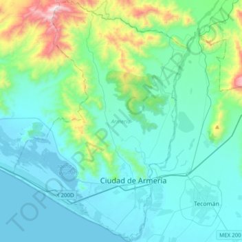
Name: Armería topographic map, elevation, terrain.
Location: Armería, Colima, Mexico (18.86435 -104.11997 19.15430 -103.89625)
Average elevation: 682 ft
Minimum elevation: -16 ft
Maximum elevation: 4,285 ft