
Kolwezi topographic map
Interactive map
Click on the map to display elevation.
About this map
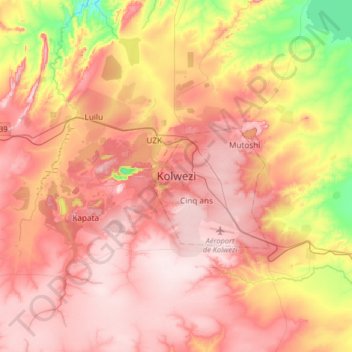
Name: Kolwezi topographic map, elevation, terrain.
Location: Kolwezi, Lwalaba, Lualaba, Democratic Republic of the Congo (-10.87700 25.30699 -10.55700 25.62699)
Average elevation: 4,688 ft
Minimum elevation: 4,039 ft
Maximum elevation: 5,089 ft