
Sadogashima topographic map
Interactive map
Click on the map to display elevation.
About this map
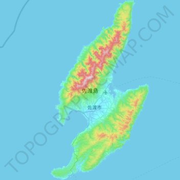
Name: Sadogashima topographic map, elevation, terrain.
Location: Sadogashima, Niigata Prefecture, Japan (37.80239 138.20373 38.33244 138.57459)
Average elevation: 197 ft
Minimum elevation: -10 ft
Maximum elevation: 3,642 ft